BAWG’s management area consists of 7.5 watersheds all draining into the Northumberland Strait. The individual watersheds within BAWG’s management zone, including their drainage area area:
- Pinette River
- Newtown (sub-watershed)
- Point Prim
- Gascoigne Cove
- Black Marsh
- Flat River
- Belle River
- Little Sands Shore
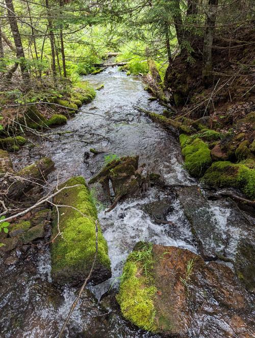
The geographic area is an estimated 22,000 hectares/54,000 acres. It extends from Eldon south to Wood Islands and east to Beach Point and includes many watercourses and an estimated 80 km of coastline.
Land use in the management region varies with agricultural land, forest stands, commercial properties, and residential and natural areas. Visit each of the watershed pages above for more detailed information.
The following maps (for each watershed) illustrate the land use patterns showcasing how the land is currently being used for residential, agricultural, commercial, conservation, and other purposes.
The legend on the maps identifies the various land use types. For example, yellow represents areas designated for agriculture, green indicates forested areas, red indicates developed zones, and blue highlights watercourses and wetlands.
What is a watershed?
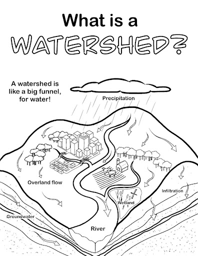
A watershed is an area of land where all the water that falls, such as rain or snow, drains into a common body of water, like a river or ocean. It includes the land, streams, and all the waterways that connect to it. A watershed is like a bowl that collects water. Imagine the land as the sides of the bowl, and when it rains, all the water flows into a central spot at the bottom, like a river or estuary. Just as a bowl gathers water from all directions, a watershed collects water from all the land within its boundaries and channels it into a common waterway.
A drainage area (a drainage basin or catchment area) for a watershed refers to the land area from which all surface water (such as rain, snowmelt, and runoff) flows into a common outlet, typically a river, stream, lake, or ocean. This area includes all the land, creeks, rivers, and tributaries that contribute water to the main body of water, draining into it. The landscape’s topography determines the drainage area’s size and boundaries, where water naturally flows toward a lower point due to gravity. Within these individual watersheds are subwatersheds. A subwatershed is a smaller, distinct area within a larger watershed, where all the water drains into a specific tributary, stream, or smaller river that feeds into the main water body of the larger watershed. It represents a more localized section of the watershed, and its boundaries are defined by the land that drains into a particular stream or river before it merges with the broader watershed. Subwatersheds are important for targeted management and conservation efforts because they can have unique characteristics and challenges compared to larger watersheds.
A buffer zone along watercourses on Prince Edward Island refers to a designated area of land that is left undisturbed or managed to protect waterways, such as rivers, streams, wetlands and coastal zones. These zones are typically vegetated areas that act as a natural barrier between the watercourse and surrounding land uses, such as agriculture, development, or forestry.
The primary purpose of these buffer zones is to protect water quality, prevent erosion, and maintain natural habitats. They are crucial in filtering pollutants like sediment, nutrients, and chemicals from surface runoff before they reach water bodies. The vegetation within the buffer zone also helps to stabilize soil, reduce erosion, and provide wildlife habitat.
In Prince Edward Island, these buffer zones are protected through regulations and land management practices to ensure the health of the island’s freshwater ecosystems, safeguard biodiversity, and maintain the sustainability of water resources for communities and agriculture. Buffer zones are part of broader conservation efforts to preserve the island’s unique environment.