• Skip to main content
  • Skip to header right navigation
  • Skip to site footer
BAWG

BAWG

Belfast Area Watershed Group | PEI

  • About Us
    • History
    • Governance and Team
    • Notable Contributors & Supporters
  • Learning Hub
    • BAWG Resources
    • Streams of Knowledge
    • Citizen Science
  • Our Watersheds
  • In the Field
    • Aquatic Monitoring
    • Wildlife Monitoring
    • Invasive Species Management
    • On the Ground
    • Current Projects
  • Friends of BAWG
  • In the BAWG
    • Newsletters

Gascoigne Cove

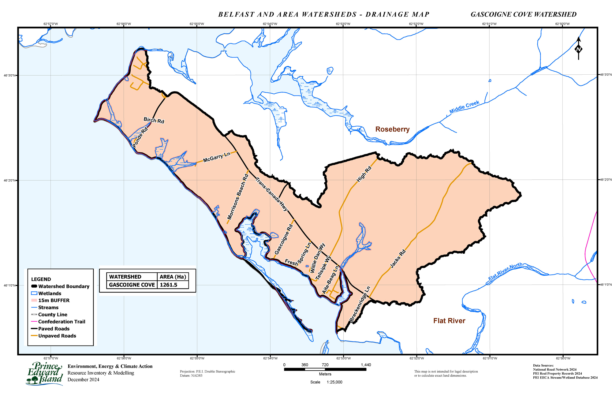
DRAINAGE GASCOIGNE COVE – The Gascoigne Cove watershed is 1261 hectares and is mainly a coastal region. Agriculture comprises 34.2% with 55.5% forest land. Wetlands make up 3% of its watershed. Due to its seaside location, it is constantly changing with tides and climatic events. In addition, recent storms have impacted its forested areas and protective hedgerows. The estuary at Bears Way is disconnected from its headwaters, impacting fish migration and natural flow regimes.

Copyright © 2026 Belfast Area Watershed Group • Website by TechnoMedia • Log in • Privacy Policy & Terms of Service