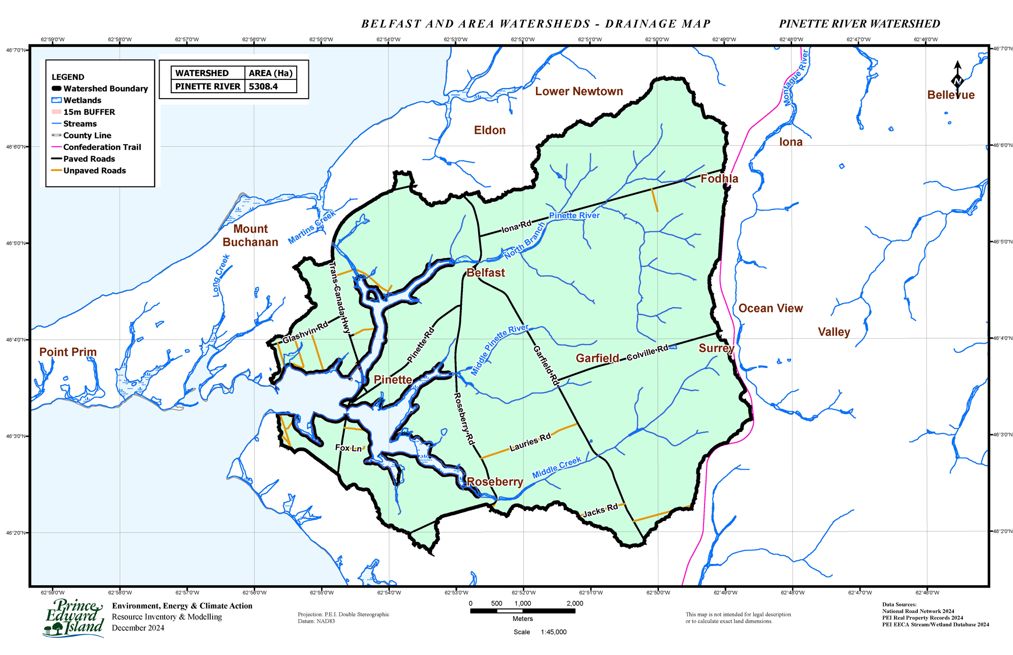
The Pinette River watershed drainage area is 5308 hectares and consists of three main branches with many sub-watersheds. Forest coverage is 59.7%, and agriculture is 33.6%.
After conducting Rapid Geomorphic Assessments on a large portion of the north branch, the watershed is currently in a transitional or stressed state due to human and historical activities. Degraded riparian zones, stream crossings, sedimentation, and a significant impoundment. This leads to multiple environmental hurdles that must be addressed to create a thriving, interconnected system.
The middle branch of the Pinette River is currently impaired due to historical changes that impact fish passage and have created sedimentation issues. Due to road infrastructure, fish passage is not possible beyond Garfield Rd. Restoration efforts can improve biodiversity, enhance the riparian zone, and rehabilitate the streams on this branch. In addition, sustainable agriculture practices are being practiced within some areas to filter runoff and repair buffer zones.
The south branch of the Pinette River has seen restoration efforts open fish passage at Roseberry Rd. by installing a fishway (2021) and through hands-on efforts in the upper regions of this sub-watershed. The forested area is of mixed wood, supporting various forest birds, providing fish cover, keeping temperatures cool, and supporting other wildlife.
Current activities on Pinette River watershed: (coming soon)
Water Quality Monitoring. For the most recent water testing data, visit our page.
DRAINAGE PINETTE RIVER – The Pinette River watershed drainage area is 5308 hectares and consists of three main branches with many sub-watersheds. Forest coverage is 59.7%, and agriculture is 33.6%.